How to Find a Land Patent for Genealogy Research | Roam your Roots
Based on Roam Your Roots's video on YouTube. If you like this content, support the original creators by watching, liking and subscribing to their content.
Search BLM GLO “Search Documents” using the ancestor’s surname and state first; add county only if the results remain unmanageable.
Briefing
Land patent research for genealogy hinges on one practical tool: the BLM General Land Office (GLO) records database. By searching by surname and state—then narrowing only when results explode—researchers can locate the exact federal land transaction tied to an ancestor. The payoff is more than a name in a database: the site provides legal details, a map-based land location, and often a digitized image of the original patent document.
The workflow starts with finding the BLM GLO site (commonly reached by searching “BLM GLO” or “GL records BLM gov”). From there, the search focuses on “Search Documents” and requires only two key inputs beyond the ancestor’s name: the state and the person’s surname. County is optional, and staying statewide can surface additional records—especially when an ancestor lived in a county the researcher didn’t initially know. First names can be added when surnames are common (like Smith or Williams), but the default approach is surname-only to avoid missing variants.
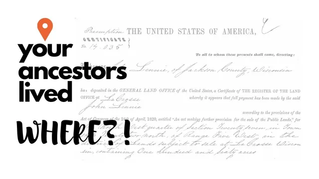
After running a search, results appear as individual patent entries tied to accession numbers. A single ancestor can generate multiple records under separate accession entries, even when the entries share the same name. In one Wisconsin example, multiple “Michael” results actually refer to the same man, while another “John” record represents a related family member. Clicking an accession link opens the patent’s core information, including the land office location (such as La Crosse for Wisconsin), the acreage (for example, 160 acres), and—crucially—the “authority” that empowered the federal government to transfer land.
That authority often appears as a specific law or program. One Wisconsin patent lists an “April 24th 1820 sale cash entry” authority, reflecting a legal framework that allowed individuals to purchase public land from the federal government. Other patents may cite military-related authorities such as warrants tied to veterans.
The most valuable genealogical feature is the map. Patent pages include township, range, section, and lot-style details (e.g., township 22, section 27, and a quarter-section like the northwest quarter). The interface then zooms to the parcel and overlays modern roads and landmarks—making it possible to visualize where the ancestor’s land sits today. The site also offers “Patent Images,” which can provide the original granted document and the legal description text used to define the property.
The transcript also flags two recurring pitfalls. First, mapping can fail with errors like “data limitations” when the section can’t be mapped precisely; the researcher is advised not to treat that as proof of an incorrect record. Second, name collisions are common, so every result must be cross-checked against other evidence such as census locations and county history. Missouri and Wisconsin examples show how the same surname can produce patents in different counties, and how a quick glance at county and geography can prevent attaching the wrong land patent to the wrong ancestor.
In short: BLM GLO records let genealogists move from a surname search to a legally defined parcel—complete with modern map context and, when available, digitized patent documents—while demanding careful verification to ensure the correct person is matched to the correct county and land description.
Cornell Notes
BLM General Land Office (GLO) records can be used to find an ancestor’s land patents by searching the database with a surname and state. Results are organized as separate accession entries, even when multiple entries refer to the same person, and each patent page includes legal land descriptions (township, range, section, and quarter sections) plus the authority law that enabled the land transfer. A key feature is the interactive map that zooms to the parcel and overlays modern roads, helping researchers connect historical land to present-day geography. The main risks are name collisions and county mismatches, so land patent matches must be cross-checked with evidence like census records. Mapping errors may occur due to data limitations and shouldn’t automatically disqualify a record.
What search inputs matter most when using BLM GLO for genealogy?
Why might one ancestor appear under multiple results with the same name?
What information on a patent page helps confirm the correct ancestor?
How does the BLM GLO map feature help genealogists?
What should researchers do when the map shows an error like “data limitations”?
How can county differences prevent attaching the wrong patent to the wrong person?
Review Questions
- When searching BLM GLO records, under what circumstances should a researcher add a first name instead of using surname-only?
- Which specific patent details (from the accession page) can be used to verify that the land record matches the correct ancestor?
- How should a researcher interpret a BLM GLO mapping error that says the section can’t be mapped due to data limitations?
Key Points
- 1
Search BLM GLO “Search Documents” using the ancestor’s surname and state first; add county only if the results remain unmanageable.
- 2
Expect multiple accession entries for the same person; each accession link contains the distinct patent details.
- 3
Use the patent’s authority (e.g., sale cash entry or military warrant-related authorities) and the legal description to understand how and where the land was transferred.
- 4
Leverage the interactive map to translate township/range/section and quarter-section language into a parcel location tied to modern roads.
- 5
Treat “data limitations” mapping errors as a record-mapping problem, not automatic evidence of an incorrect ancestor match.
- 6
Always cross-check county and geography from the patent against independent evidence such as census records to avoid name-collision mistakes.