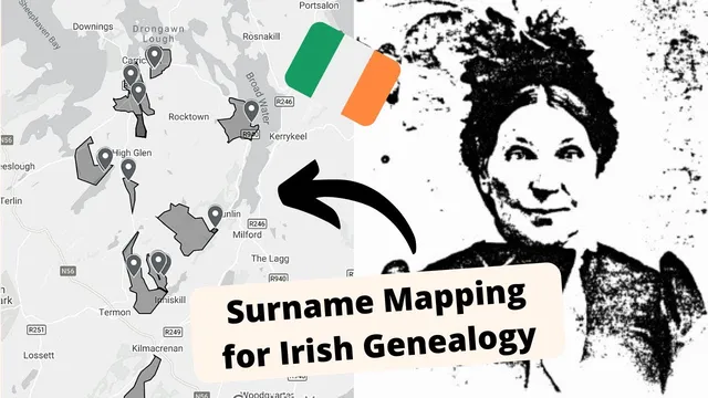
Mapping Irish Ancestors using Griffith's Valuation | Narrow down your Irish roots!
Based on Roam Your Roots's video on YouTube. If you like this content, support the original creators by watching, liking and subscribing to their content.
Plot every Griffith’s Valuation entry for a chosen surname within a target county to create a spatial map of where households actually lived.
Briefing
A practical way to narrow down Irish roots is to map surname entries from Griffith’s Valuation onto a modern, interactive map—then use the resulting clusters to infer which families likely stayed in the same neighborhoods. For one Donegal line with the relatively rare surname “Linaoz/Lina,” the approach produced a county-level picture of where related households may have lived, even when the mapped individuals were not direct ancestors.
The project starts with a simple constraint: Griffith’s Valuation lists people by parish and townland, and it often includes the specific location of a household within a townland. The researcher focused on County Donegal because the family line is documented as having come from there, but the family emigrated before Griffith’s Valuation was completed—meaning the mapped entries weren’t the direct line. Still, the logic is that nearby entries with the same surname could represent siblings, cousins, or other close relatives who remained behind.
The mapping work begins by searching Griffith’s Valuation for every entry of the surname in the target county. In this case, there were only 23 entries for “Linaoz/Lina” in Donegal, making the task manageable. Each relevant page is reviewed to identify the townland names, and then those townlands are plotted onto a customizable Google My Maps layer. The map uses townland outlines (drawn in a “blob” style for starting points) and adds blue pinpoints for the household locations. Griffith’s Valuation provides the internal structure of a townland through numbered/lettered locations, which the researcher translates into exact pins on the map.
To go beyond simple dots, the project sometimes outlines larger property areas when Griffith’s Valuation indicates multiple people renting or occupying the same land parcel. That extra detail helps visualize how households shared property boundaries and likely lived in close proximity.
The payoff comes from pattern recognition. A long list of names in Griffith’s Valuation is hard to interpret, but once plotted, clusters emerge—small groups of households living near each other. Those clusters can suggest likely family relationships (for example, brothers or a father with sons) because close neighbors in the same townland area were often related.
Finally, the tutorial portion shows how the mapping is done in practice. Townlands are located using townlens.ie to obtain outlines, then Griffith’s Valuation is used to match household location codes (like “3” and “A”) to a specific spot within the townland. The researcher then cross-checks the pinpoint using satellite imagery in Google Maps, which can reveal whether a building still exists and can also validate whether the household location was mapped accurately.
Overall, the method is most effective when the surname is rare or when the number of entries in the county is limited; with common surnames, the workload becomes too large. For rare surnames, though, mapping turns Griffith’s Valuation from a static record into a spatial tool for narrowing where families likely originated and which cemeteries or local areas deserve deeper research.
Cornell Notes
Mapping Griffith’s Valuation entries for a surname onto a modern map can reveal where families likely lived within a county. By plotting every household location for a rare Donegal surname (“Linaoz/Lina”) across townlands, the researcher created clusters that make kinship guesses easier than reading long name lists. Griffith’s Valuation often includes internal location identifiers (numbers/letters) that can be translated into precise map pinpoints within each townland. Even when the mapped individuals aren’t direct ancestors, nearby households may represent siblings, cousins, or other relatives who stayed in Ireland. Satellite view can then help verify whether the mapped spot aligns with existing structures, improving confidence in the work.
Why does mapping Griffith’s Valuation entries help more than reading the surname list alone?
How does the method translate Griffith’s Valuation into a pinpoint on a modern map?
What role does surname rarity play in whether this project is practical?
If the mapped people aren’t direct ancestors, how can the map still be useful?
How can property outlines improve relationship inference?
Why check satellite imagery after placing a pinpoint?
Review Questions
- What specific information in Griffith’s Valuation enables household-level pinpoints within a townland (not just townland names)?
- How would the strategy change if the surname had hundreds of entries in the county rather than 23?
- What kinds of family relationships are most plausible when surname households cluster tightly on the map, and why?
Key Points
- 1
Plot every Griffith’s Valuation entry for a chosen surname within a target county to create a spatial map of where households actually lived.
- 2
Use townland boundaries (e.g., from townlens.ie) so household pinpoints land in the correct geographic area.
- 3
Translate Griffith’s Valuation internal location identifiers (numbers/letters) into map pinpoints within each townland.
- 4
Look for clusters of the same surname across nearby townlands; tight grouping can suggest close kinship such as siblings or a father/sons pattern.
- 5
When Griffith’s Valuation indicates shared parcels (renters or multiple people on one property), outline the property area to better visualize household proximity.
- 6
Validate pinpoints with satellite imagery to gauge whether buildings still exist and to assess mapping accuracy.
- 7
Prioritize this approach when the surname is rare or has a limited number of entries; common surnames can make the workload impractical.