Mapping my Ancestor's ENTIRE Life with Google My Maps | Roam Your Roots
Based on Roam Your Roots's video on YouTube. If you like this content, support the original creators by watching, liking and subscribing to their content.
Pin each census and address entry into a single map to convert scattered facts into a readable life timeline.
Briefing
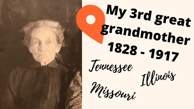
A genealogy mapping project turns scattered census entries and addresses into a single, visual timeline of third great-grandmother Sarah Booth’s life—highlighting how close “different” places can be and how much uncertainty remains about where she actually lived. Born in Tennessee in 1828 and dying in St. Louis in 1917, Booth’s records point to repeated moves across multiple states and counties. By pinning each known location into a fresh Google My Maps workspace (“sarahbooth life”), the project aims to make those moves easier to track, spot patterns, and identify where additional records might be hiding.
The mapping begins with Booth’s early life in Tennessee. Her birth state is known, but the exact birthplace isn’t; instead, the 1830 census places her father in Perry County, Tennessee. To ground that county in the right historical geography, the mapper uses a Library of Congress Tennessee map dated 1832 to approximate Perry County’s boundaries as they likely existed in 1830—so later searches for land or local records won’t accidentally target the wrong jurisdiction.
Next comes the 1840 census, which is treated as evidence that Booth’s family lived in Jackson County, Tennessee. To visualize that, the mapper pulls a Library of Congress map dated 1836 and attempts to plot Jackson County’s relevant towns. The process is imperfect—some town names are hard to locate—yet it establishes a working “where” for Booth’s childhood and for later research.
The project then pivots to Illinois, where Booth’s marriage and subsequent census listings suggest rapid relocation. In 1848, Booth is married in Jackson County, Illinois, and by 1850 she and her husband are listed in Liberty, Randolph County, Illinois. The mapper notes that Liberty no longer exists as a town name and treats it as corresponding to today’s Rockwood, Illinois. A key insight emerges when the map is zoomed in: Jackson County and Randolph County appear to meet near Rockwood/Liberty, meaning Booth may have “moved” across a county line rather than across the state. That raises practical questions about boundary changes between 1848 and 1854 and whether township or county lines shifted over time.
By 1860, Booth is in Washington County, Missouri, living in a township identified as Concord Township (with later references to Bellevue Township). The mapper corrects a common assumption: Bellevue Township did not necessarily cover Bellevue, Missouri itself; instead, it appears centered around Caledonia, with Bellevue located in a different, unnamed township area. In 1880, Booth is listed in Iron Mountain in St. Francois County and works as a hotel keeper—another concrete anchor point added to the map. In 1900, she is living in Bismarck with her son Douglas, and in the final census she is a boarder at 2 to 8 North Taylor Avenue in St. Louis.
The mapping ends with her death certificate address (5 667 Von Verson Street, later associated with Enright Avenue) and her burial at Belfontaine Cemetery in St. Louis. The result is less a finished answer than a structured set of hypotheses: the map clarifies the likely travel path, exposes mismatches between township assumptions and census labels, and surfaces new questions—such as where exactly within each county she lived and how family events (including her mother’s remarriage in 1837 in Gallatin County) fit into the timeline.
Cornell Notes
Sarah Booth’s life is reconstructed as a set of mapped pins and shapes in Google My Maps, using census entries, marriage location, and later addresses. The central payoff is perspective: places that look far apart on paper (Jackson County vs. Randolph County in Illinois) may be adjacent in reality, suggesting county-line changes or short-distance moves. The project also corrects assumptions about Missouri townships, noting that Bellevue Township likely centered around Caledonia rather than Bellevue, Missouri. By plotting each known location—plus burial at Belfontaine Cemetery—the mapper turns uncertain research into a navigable checklist of where to look next (land records, boundary history, and local jurisdictions).
How does the project handle uncertainty about where Sarah Booth was born within Tennessee?
What “map-driven” insight emerges from Booth’s Illinois records?
Why does the project question assumptions about Bellevue, Missouri?
What concrete occupational and location detail is added for 1880?
How are Booth’s St. Louis addresses handled, given possible street-name changes and ambiguity?
What role does family history play beyond census locations?
Review Questions
- Which specific record is used to justify placing Sarah Booth’s early Tennessee pin in Perry County, and how does the project verify the county’s historical boundaries?
- What evidence suggests Booth’s Illinois moves might be short-distance rather than across the state, and what new research questions does that raise?
- How does the project’s treatment of Bellevue Township change the interpretation of later Missouri census locations?
Key Points
- 1
Pin each census and address entry into a single map to convert scattered facts into a readable life timeline.
- 2
Use historical boundary references (e.g., Library of Congress maps) to avoid searching the wrong county jurisdiction for older records.
- 3
Treat “different counties” as a clue to check adjacency and possible boundary changes, not just as proof of long-distance relocation.
- 4
Validate township assumptions—township names and town names often don’t line up cleanly in census-era geography.
- 5
When street names or addresses may have changed, triangulate using neighboring streets and cross-check with death certificates.
- 6
Add non-census family events (like remarriages) to explain gaps and strengthen the narrative behind geographic moves.
- 7
Expect the map to generate new questions; use it as a research roadmap for land records, local histories, and boundary historians.