The Bike Lanes You Can't See - Ontvlechten
Based on Not Just Bikes's video on YouTube. If you like this content, support the original creators by watching, liking and subscribing to their content.
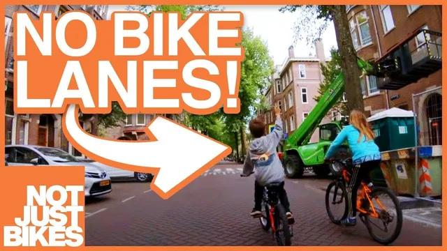
Dutch cities reduce car-bike conflicts by designing separate route networks for cars, bicycles, transit, and walking rather than sharing one system.
Briefing
Separated bike lanes are often treated as the “gold standard” for safety because they physically keep cyclists away from fast, heavy vehicles. But the Netherlands adds a second layer that’s harder to see: road networks are deliberately “disentangled,” so cyclists, pedestrians, and transit riders can move through the city with minimal conflict with cars—even when the street doesn’t look like it has bike infrastructure.
In most cities, everyone shares the same road network. When congestion hits, drivers cut through nearby neighborhoods, turning local streets into a free-for-all that increases traffic and car dependency. Suburban cul-de-sacs can reduce through-traffic for residents, but they also make walking and cycling impractical by forcing long, indirect routes—pushing more trips into cars.
Dutch planning takes a different approach by designing separate route structures for different modes. Instead of one shared network, cities build “H Nets” (main networks) that separate car routes from routes used by bicycles, public transportation, and walking. Amsterdam goes further with “Plus Nets,” which assign priority across the network—down to details like traffic-signal timing and how road space is allocated. A single corridor can belong to multiple Plus Nets; for example, a street may be part of both bicycle and tram priority networks, leading to the removal of a car lane to create space for cyclists and trams.
This disentangling shows up in everyday routing. Bicycle networks often include bike-only roads and, where possible, grade-separated crossings (such as underpasses) that remove the need for stoplights. Walking and cycling routes may also cut through city parks, making the most direct paths feel pleasant rather than hostile. Access control is enforced with signs and physical barriers—an idea urban planners describe as “filtered permeability.” The goal isn’t to block everyone; it’s to allow through-movement for the intended modes while restricting cars to local destinations.
Crucially, these networks aren’t a substitute for proper bike lanes on busy streets. Dutch cities still use separated bicycle infrastructure on major roads, especially on streets that have been redesigned in recent decades. The difference is that even when a street looks car-dominant, cyclists can often travel along a bicycle H Net or Plus Net corridor and rarely need to cross paths with cars.
The payoff is both safety and efficiency. When car routes are constrained to local access and cyclists have faster, more direct paths, the city doesn’t become gridlocked with cars. Amsterdam faced a similar problem in the 1970s—streets clogged and dangerous—yet the Netherlands’ network approach reduced car dominance without requiring every trip to be “driveable” from anywhere. The result is a system where cycling can feel relaxing and safe, not because every street is visibly bike-lane covered, but because the underlying network quietly keeps cars from dominating the places people actually need to go.
Cornell Notes
Dutch cities use “disentangling” to reduce conflicts between cars and active travel. Instead of one shared road network, planners create separate route systems: H Nets for main networks and Plus Nets that set priority (including signal timing and space allocation). Bicycle and walking networks often include bike-only roads, grade-separated crossings, and park routes, while “filtered permeability” allows pedestrians and cyclists through but restricts cars to local destinations. These networks work alongside—rather than replacing—separated bike infrastructure on busy streets. The outcome is that cyclists can take fast, direct routes with far fewer car encounters, improving safety and preventing the kind of car congestion seen when everyone relies on the same routes.
What problem does “disentangling” try to solve compared with typical city road design?
How do H Nets and Plus Nets differ, and what do they control?
What does “filtered permeability” mean in practice?
Why doesn’t giving cyclists faster routes automatically create worse car congestion?
How do Dutch networks relate to visible bike infrastructure like separated lanes?
Review Questions
- How do H Nets and Plus Nets change routing compared with a single shared road network?
- Give two examples of design features that support bicycle or walking networks (e.g., grade separation, park routing, bike-only roads).
- Why does filtered permeability aim to restrict cars to local destinations rather than block all movement?
Key Points
- 1
Dutch cities reduce car-bike conflicts by designing separate route networks for cars, bicycles, transit, and walking rather than sharing one system.
- 2
H Nets define main networks for different modes, while Plus Nets set priority details such as traffic-signal timing and road-space allocation.
- 3
A corridor can serve multiple priority networks at once (e.g., bicycle and tram), which can require removing car lanes to rebalance space.
- 4
Filtered permeability uses signs and physical barriers to let pedestrians and cyclists take direct routes while limiting car access to local destinations.
- 5
Bicycle networks often include bike-only roads, grade-separated crossings like underpasses, and routes through parks to keep trips direct and comfortable.
- 6
These mode-specific networks work alongside separated bike infrastructure on busy streets, not as a substitute for it.
- 7
Constrained car routing helps prevent the citywide congestion that would occur if drivers had equally direct routes everywhere.